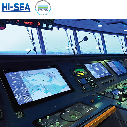
Overview of Navigation Equipment for New Boaters
In ancient times, ocean voyages took from a few months to several years. In modern, even with advanced technology, ocean crossings typically take a minimum of several days. Do you know how modern ships navigate through the vast and tumultuous seas to reach their destinations smoothly? This article will help you become familiar with the essential navigation equipment required for modern ships, ensuring that you can select navigation equipment with ease and confidence.
Overview
Voyage data recorder (VDR)
This device is installed on a ship to continuously record important information related to the operation of the ship. It contains a voice recording system for at least the last 12 hours. This record is restored and used for incident investigation.

Rudder angle indicator
This device shows the steering angle. The display is located on the bridge equipment console, so the ship's navigator can control the steering speed and rudder angle. The indication is also provided in the bridge wing and in the engine control room.

Marine sextant
This device is a kind of reflection type angular measuring optical instrument. It is used to measure the altitude of celestial bodies to determine the position of the ship at sea, the two horizontal angles between three known position land objects the ship location on chart by the help of a station pointer, the vertical angle of a known altitude object to obtain its distance.

Speed log
The speed log is an instrument used for measuring the distance traveled at sea, its functions include measuring speed and cumulative distance traveled. The device adopts dual-beam system, effectively reducing the metering error. Data can be output to radar, electronic chart, AIS system, VDR and other equipment. When in use, please note to stop using and stow the speed log before the ship docks to avoid damage. When navigating in complex maritime areas or adverse weather conditions, the speed log should remain operational to provide evidence favorable to you in case of potential ship collision accidents.

Marine Anemometer
This device is used to measure and indicate the speed of the wind on a ship or a marine vessel. It plays a crucial role in maritime operations, providing sailors with real-time information about wind speed.

GPS (Global Positioning System)
GPS receivers use signals from satellites to determine the exact location of a vessel. This technology is fundamental for accurate navigation. It has Advanced speed, heading, and altitude stabilization technology; built-in highly stable speed and course GNSS receiver, AIS performance and high reception sensitivity. It includes Beidou/ GPS dual-mode positioning, supporting ship position report, real-time ship dynamic retrieval. It also has large-capacity storage unit to automatically record the ship’s voyage data.

Radar
Radar systems use radio waves to detect and locate objects, providing information about their distance, direction, and speed. This is essential for avoiding collisions and navigating in low visibility conditions.

Fish finder
This is a sonar device that operates at high frequencies to locate schools of fish. It sends sound waves into the water, receiving echoes from the seabed or fish schools. The device also provides information about the distance between the ship and the fish. Additionally it can storage and replay echo data and rapidly updating software.

Marine Chartplotter
This is a marine navigation device that combines GPS data with an electronic navigational chart (ENC). It presents the ENC on a display alongside the ship's position, heading, and speed. Additionally, it can show supplementary information gathered from radar, automatic information systems (AIS), or other sensors.

Depth Sounder
This device is used to measure the depth of water below the bottom of a ship using sound waves, which work on the principle of sound wave transmission, and a sound pulse that bounces off a reflective layer and returns as an echo to the source.

Sonar
Sonar systems use sound waves to measure water depth and locate underwater objects. This is especially important for navigation in shallow waters and for avoiding submerged hazards.