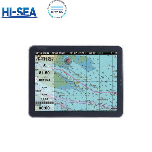
Multi-operating Mode Electronics Chart System
The Multi-Operating Mode Electronics Chart System is a versatile navigation tool designed to adapt to various maritime needs. It offers multiple operating modes, including navigation, route planning, and monitoring, to provide comprehensive situational awareness. The system features detailed electronic charts, real-time GPS positioning, and seamless integration with AIS and radar systems. Its user-friendly interface allows for easy switching between modes, ensuring efficient and accurate navigation in diverse marine environments.
Overview
Feature
Touch screen operation, remote control plus mouse and keyboard optional;
Global chart, international standard S57/63, support satellite image chart;
Support VGA or HDMI display;
Built-in AIS optional.
Product display

Model | IECS-12 | IECS-15 | IECS-17 | IECS-19 |
Display | 12” | 15” | 17” | 19” |
Resolution | 800*600px | 1024*768px | 1280*1024px | 1280*1024px |
Power Supply | DC24V(11~35V) | |||
Power | High-performance,full isolated,PWM control of power supply | |||
Mount | Bracket Mount or Flush Mount | |||
Power Consumption | ≤20W | |||
Language | Simple Chinese,Traditional Chinese,English(Can be customized) | |||
Map Format | S57,S63(ENC),CJ57,CJ63 | |||
Map Display Mode Heading Up,Course Up,Route Up,North Up,East Up,South Up,West Up | ||||
Navigation Data | Bearing,Present Distance,Distance to the Destination,Yaw Distance,Yaw Angle, | |||
Others | Time,Depth,Wind Speed,Wind Direction,Simple Compass,etc. | |||
Data Display Mode | Top Display Various Arrangement),Left Display,Right Display,Suspension Display | |||
User Data | ≥50000 way points,200 routes,10000 way points/route 20000 tracks, | |||
Chart program upgrade USB upgrade,network upgrade | ||||
AIS Functions | AIS Display,AIS Message,AIS Log,AIS Fleet Management,AIS Fishing Net | |||
System Alarm | Loss Alarm,Time Alarm,Low Voltage Alarm,High Voltage Alarm,No | |||
Navigational Alarm | Yaw Alarm,Arrival Alarm,Anchor Drag Alarm,Bridge Alarm,Danger Alarm, | |||
Other Functions | Measuring Distance,Compass Superposition,Eccentric Setting,Calendar, | |||
Receiving Type | Customized Positioning Source(GPS,Beidou,Glonass,Galileo) | |||
Receiving Channel GPS:1575.42MHz Beidou:1561.098MHz | ||||
Positioning Time | Cold Start:45s Hot Start:15s | |||
Positioning Accuracy GPS:<15m(95%)Beidou:Horizontal 25m(95%)Vertical 30m(95%) | ||||
Input(NMEA0183) | GPS,AIS,Compass,Depth,Water Temperature,etc. | |||
Output(NMEA0183) | GPS:GGA、GLL、GSA、GSV、RMC、VTG、ZDA | |||
Operate | keyboard;remote control;touch screen | |||
Frequency | AIS 1:87B/161.975MHz AIS2:88B/162.025MHz | |||
Bandwidth | 25KHz | |||
Output Power | 2W | |||
Modulation Mode GMSK | ||||
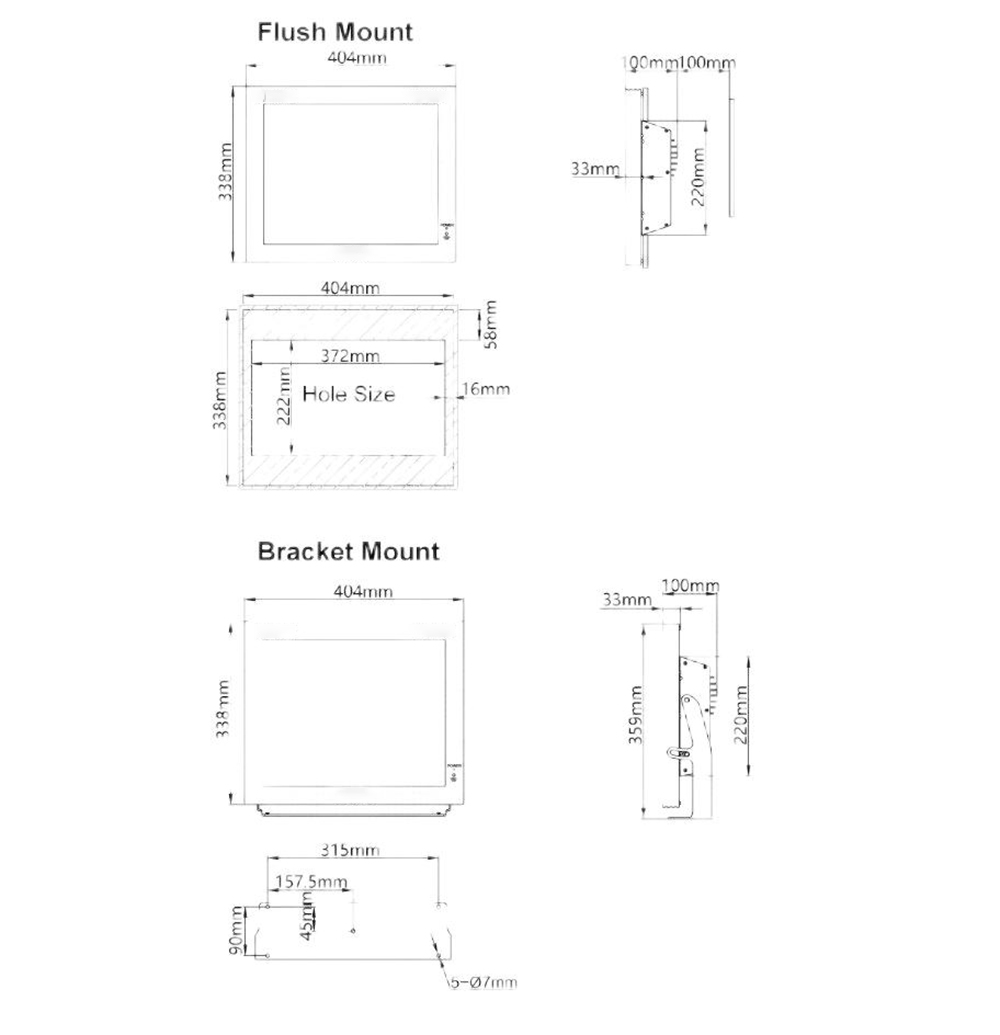
Installation dimension


